Tocht Lopen La Cresse - Millau Espace Trail N°6 - Photo

Millau Espace Trail N°6

 gbarrabe
gbarrabe

Gebruiker

© OpenStreetMap contributors
Lengte
Lengte
11,7 km
Max. hoogte
Max. hoogte
856 m
Positief hoogteverschil
499 m
Km-Effort
Km-Effort  
18,4 km
Min. hoogte
Min. hoogte
410 m
Negatief hoogteverschil
500 m
Boucle
Boucle
Ja
Markering
Markering
Datum van aanmaak :
2015-04-23 00:00:00.0
Laatste wijziging :
2015-04-23 00:00:00.0

(0 Bericht)

Lopen
Lopen
1h27
Moeilijkheid : Gemakkelijk

Scan deze QR-code om de tocht te openen in de SityTrail-applicatie

Gratisgps-wandelapplicatie

Logo SityTrail SityTrail

IGN / Geografische instituten

SityTrail uit de App Store downloaden SityTrail uit Google Play downloaden

Logo SityTrail SityTrail World

De wereld gaat voor u open

SityTrail uit de App Store downloaden SityTrail uit Google Play downloaden SityTrail op Huawei AppGallery downloaden

Over ons

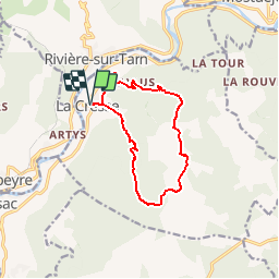
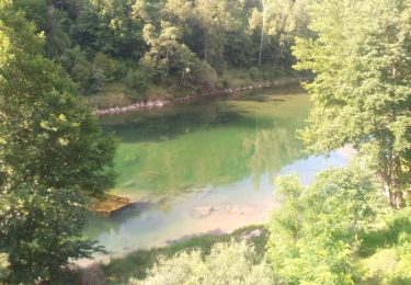
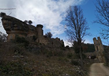
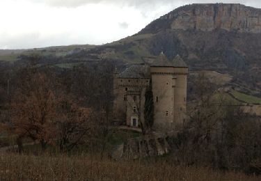
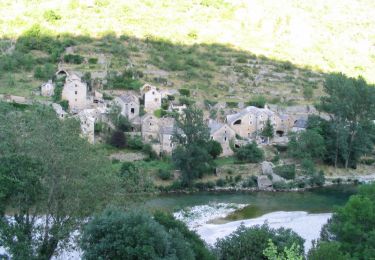
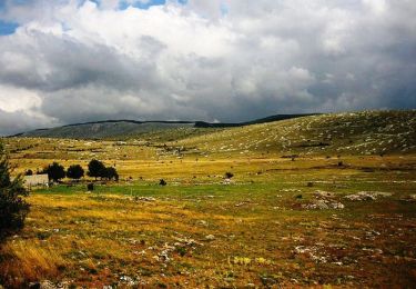
Tocht Lopen van 11,7 km beschikbaar op Occitanië, Aveyron, La Cresse. Deze tocht wordt voorgesteld door gbarrabe.

Beschrijving

Parcours 6 - La Cresse - Le Causse Noir / millauespacetrail.com

Hoogteprofiel

Plaatsbepaling

Land:
France
Regio :
Occitanië
Departement/Provincie :
Aveyron
Gemeente :
La Cresse
Locatie:
Unknown
Vertrek:(Dec)
Vertrek:(UTM)
510448 ; 4891625 (31T) N.

Wandeltochten in de omgeving

Tocht Stappen Mostuéjouls - J7: Mostuéjouls-Millau-150522 - Photo
Stappen
canardDenis

Stappen

Medium
Mostuéjouls, Occitanië, Aveyron, France
22 km | 31 km-effort
6h 57min
Neen
Tocht Stappen Rivière-sur-Tarn - Fontaneilles, château de Peyrerade, Piedestal - Photo
Stappen
francislassauce

Stappen

Moeilijk
Rivière-sur-Tarn, Occitanië, Aveyron, France
7,8 km | 12,7 km-effort
3h 36min
Ja
Tocht Stappen La Cresse - la cresse, belvédère de caylus - Photo
Stappen
francislassauce

Stappen

Medium
La Cresse, Occitanië, Aveyron, France
6,9 km | 11,3 km-effort
3h 12min
Ja
Tocht Trail Mostuéjouls - Le Rozier - Photo
Trail
Atchoum26

Trail

Heel gemakkelijk
Mostuéjouls, Occitanië, Aveyron, France
9,2 km | 13,3 km-effort
1h 41min
Neen
Tocht Stappen Rivière-sur-Tarn - Puech de Fontaneilles - Photo
Stappen
ZITO12

Stappen

Gemakkelijk
Rivière-sur-Tarn, Occitanië, Aveyron, France
10,4 km | 16,2 km-effort
4h 53min
Ja
Tocht Stappen Rivière-sur-Tarn - Grands Causses - Peyrelade - Chateau-vignes-forêt - 2016 09 09 - Photo
Stappen
Orcal37

Stappen

Medium
Rivière-sur-Tarn, Occitanië, Aveyron, France
9,9 km | 15,2 km-effort
3h 30min
Ja
Tocht Stappen Compeyre - les 3 chateaux - Photo
Stappen
colber

Stappen

Heel gemakkelijk
Compeyre, Occitanië, Aveyron, France
16,3 km | 22 km-effort
3h 53min
Ja
Tocht Mountainbike Mostuéjouls - Causse Méjean - Gorges du Tarn - Photo
Mountainbike
tracegps

Mountainbike

Zeer moeilijk
(2)
Mostuéjouls, Occitanië, Aveyron, France
87 km | 113 km-effort
12h 0min
Ja
Tocht Mountainbike Aguessac - GéoBike - Tour des Grands Causses - édition 2009 - Photo
Mountainbike
tracegps

Mountainbike

Zeer moeilijk
Aguessac, Occitanië, Aveyron, France
225 km | 295 km-effort
0h 0min
Ja


Sluiten
Mijn abonnementen